Maps Page on South
America (Colombia, Ecuador, Peru & Chile)
Outline
- Physical Environment
- Colombia Land Use Map
- Ecuador Vegetation Map
- Chile Vegetation Map
- Weather & Climate
- Colombia Climate Map
- Ecuador Climate Map
- Peru Climate Map
- Human Environment
- Colombia Population Map
- Ecuador Population Map
- Peru Population Map
- Road maps
- Ecuador Road Map
- Colombia Road Map
- Chile Road Map
- City Maps
- Santiago Map
- Lima Map
- Bogota Map
- Urban Transportation Maps
- Santiago Subway Map
- Lima Metropolitan Map
- Bogota Transportation
Map
- Tourist Maps
- Colombia Tourist Map
- Santiago Tourist Map
- Lima Tourist Map
1 Physical
Environment

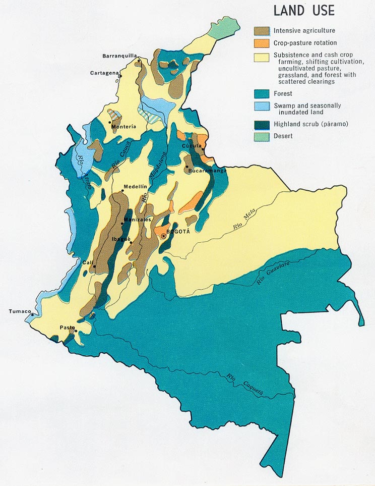
This map shows the overall land use in Colombia depicted by
color representation.
Colombia
Land Use
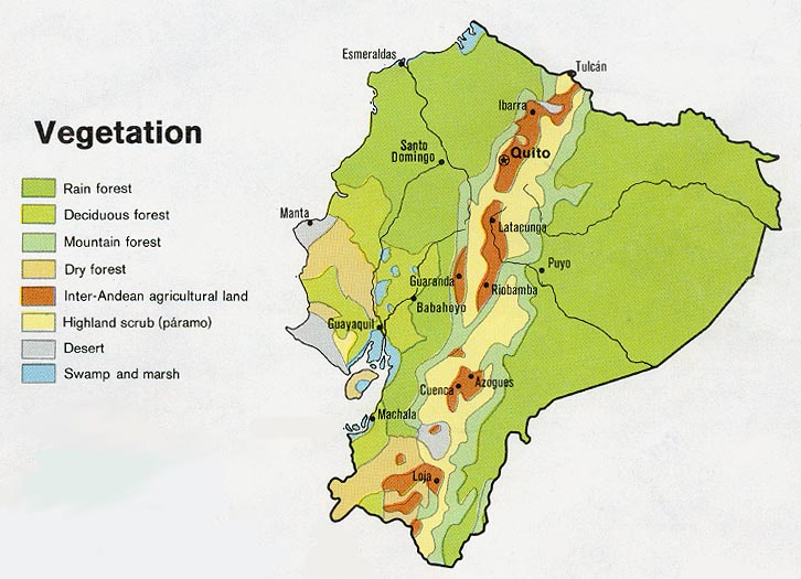
The Ecuador Vegetation map shows the different land cover over
the country of Ecuador.
Ecuador
Vegetation
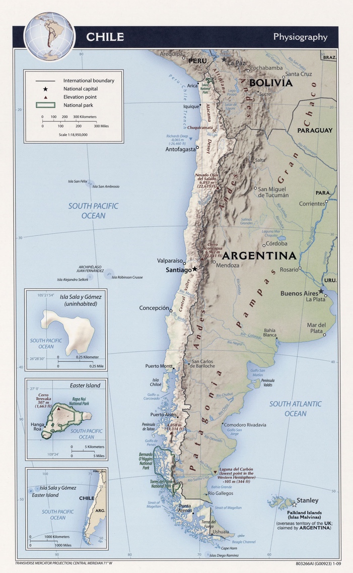
This map shows elevation of the Andes mountain range along the border of Chile.
Chile
Physiography
2 Weather &
Climate
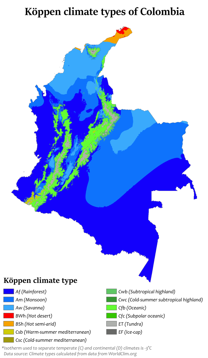
This shows the climate types throughout the country of
Colombia.
Colombia
Climate Map
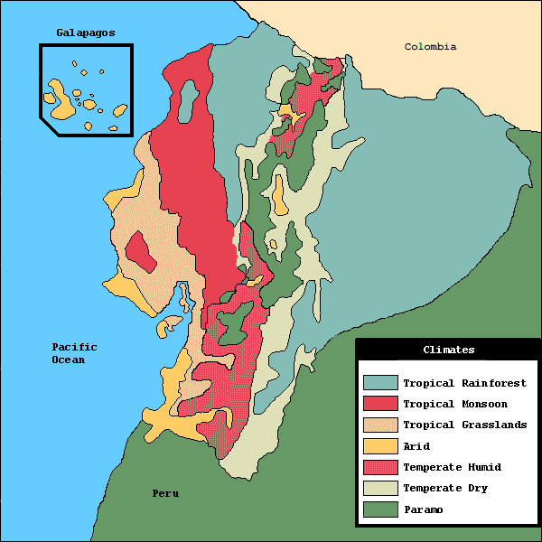
This map displays the climates throughout the country of Ecuador.
Ecuador Climate Map
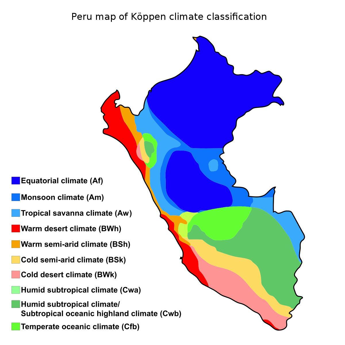
This map of Peru shows the climate types throughout the
country.
Peru Climate Map
3 Human Environment

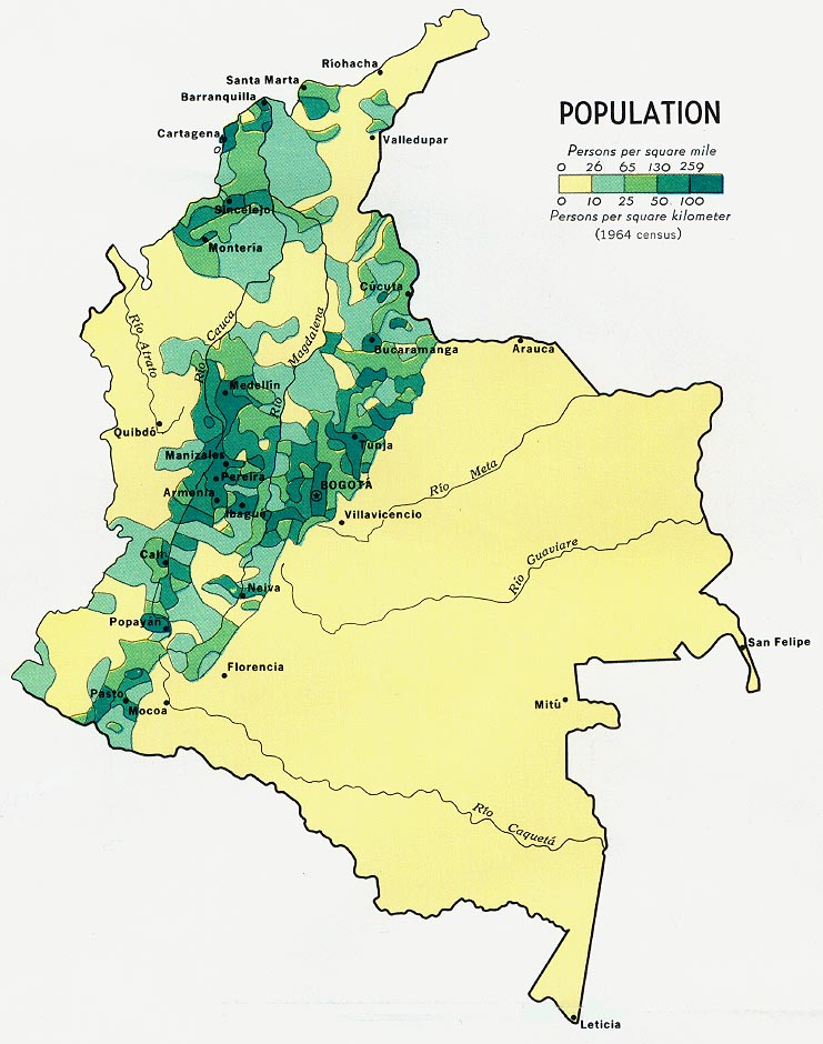
This map displays the number of persons per square mile in
Colombia.
Colombia
Population
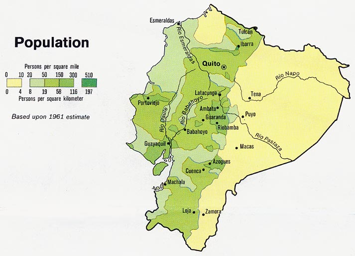
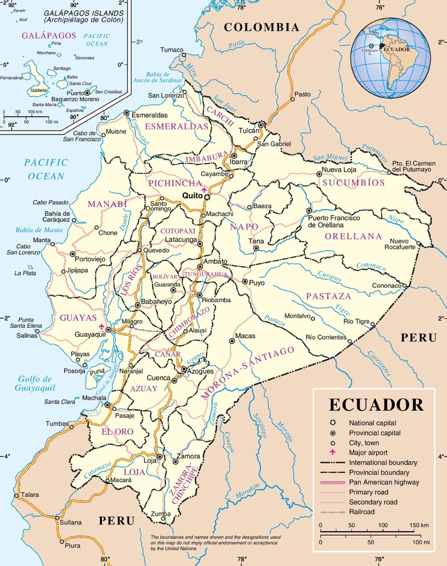
Here we have the population of Ecuador represented by
persons per square mile.
Ecuador
Population

This displays the population of the country of Peru.
Peru Population
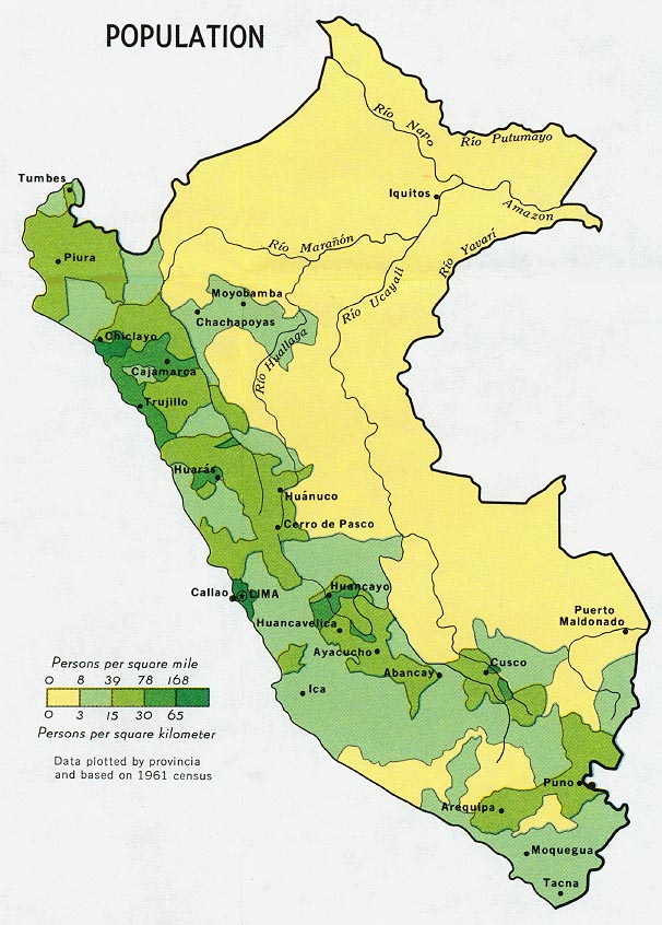
4 Road Maps
This map represents the main highway and roads of Ecuador.
Ecuador Roads
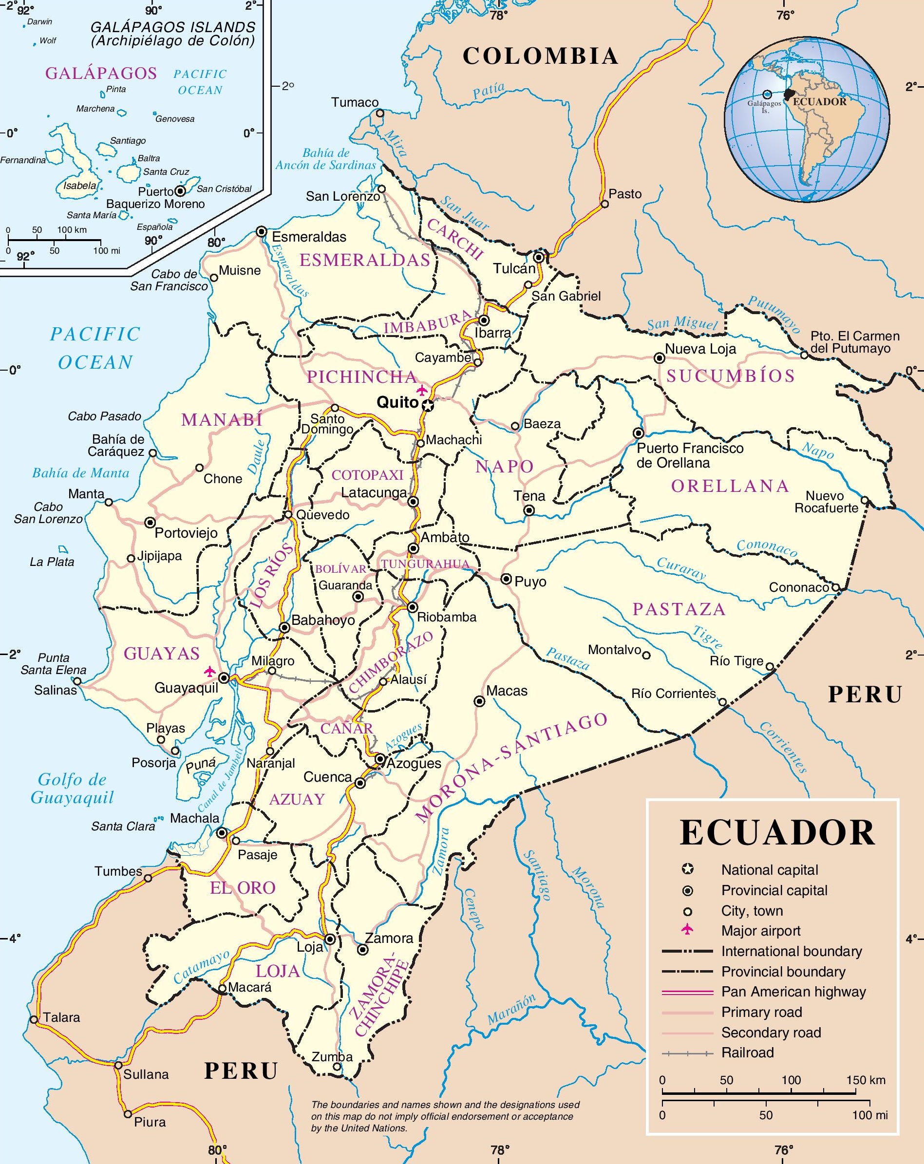
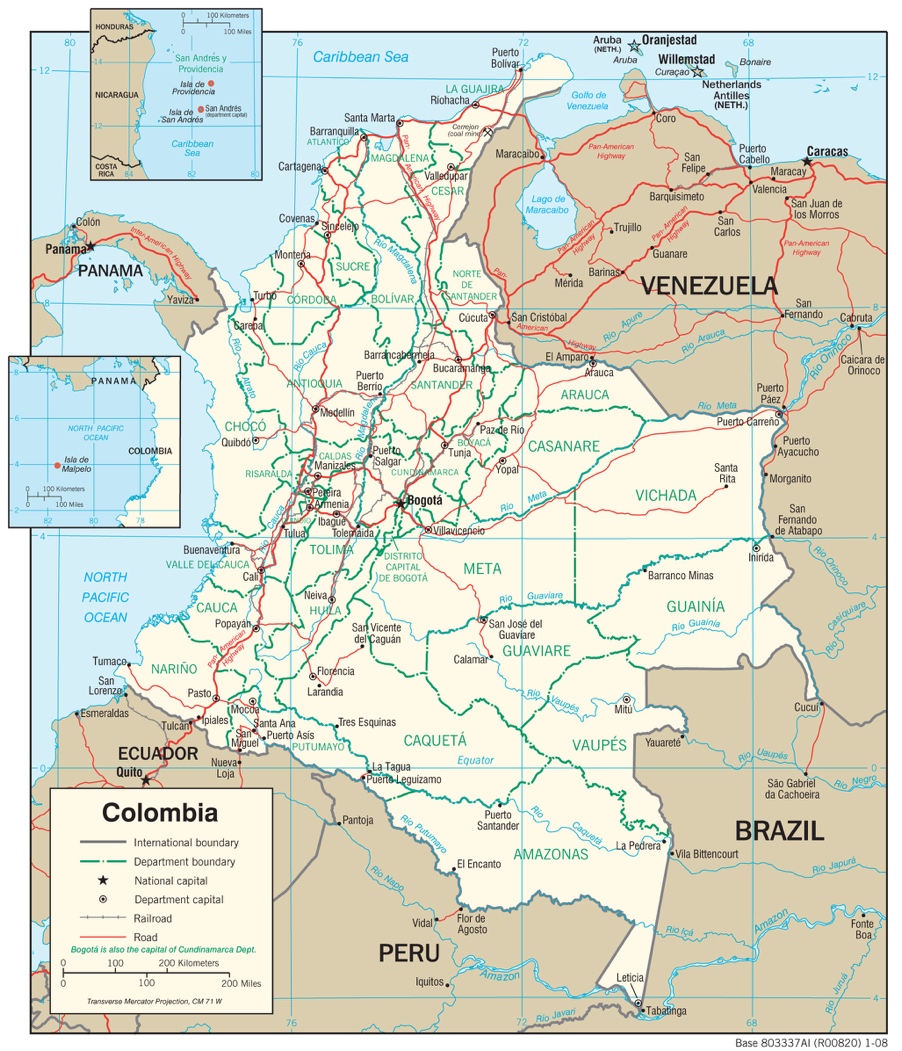
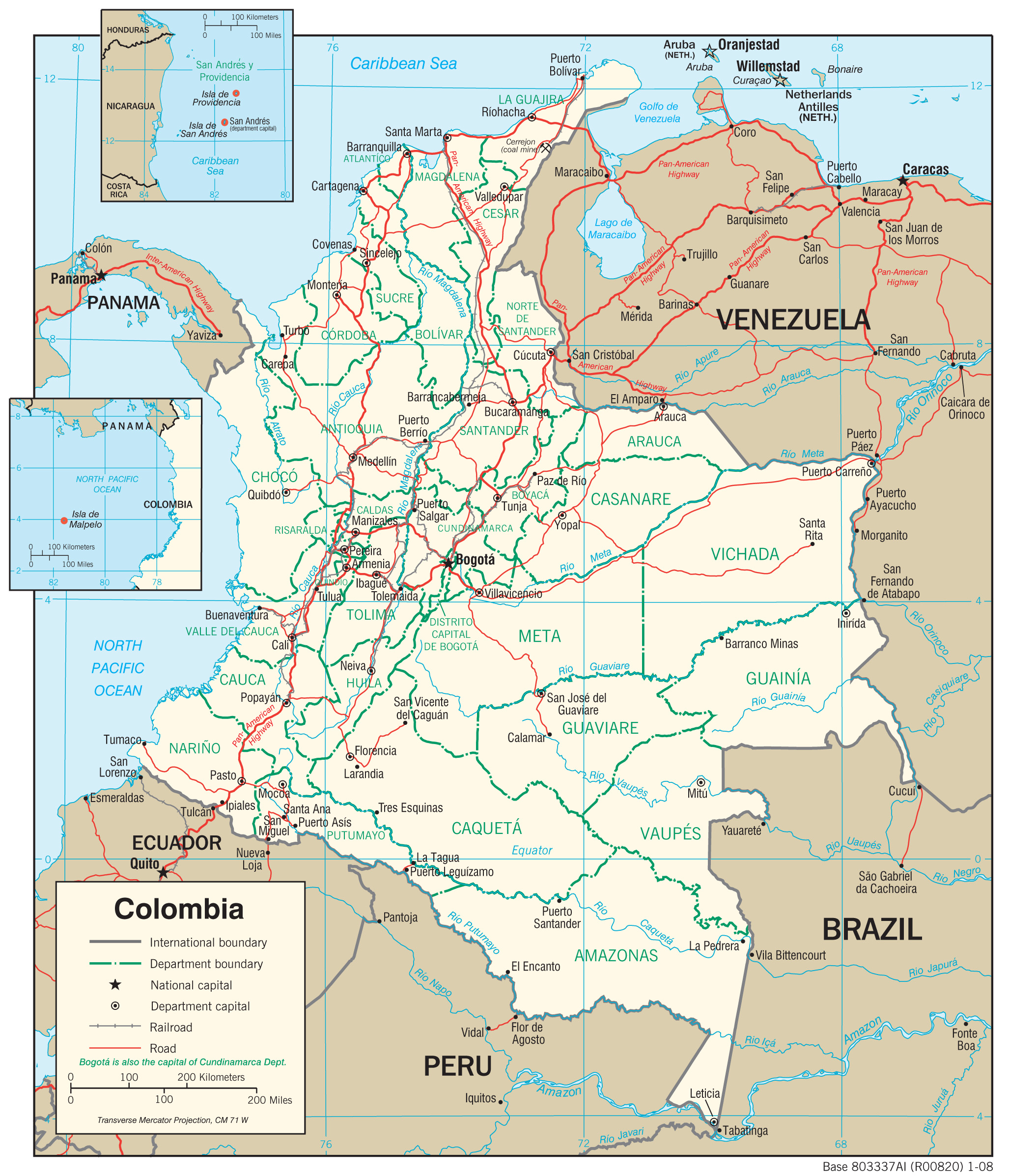
Here
we have the railway and main roads of Colombia.
Colombia
Roads
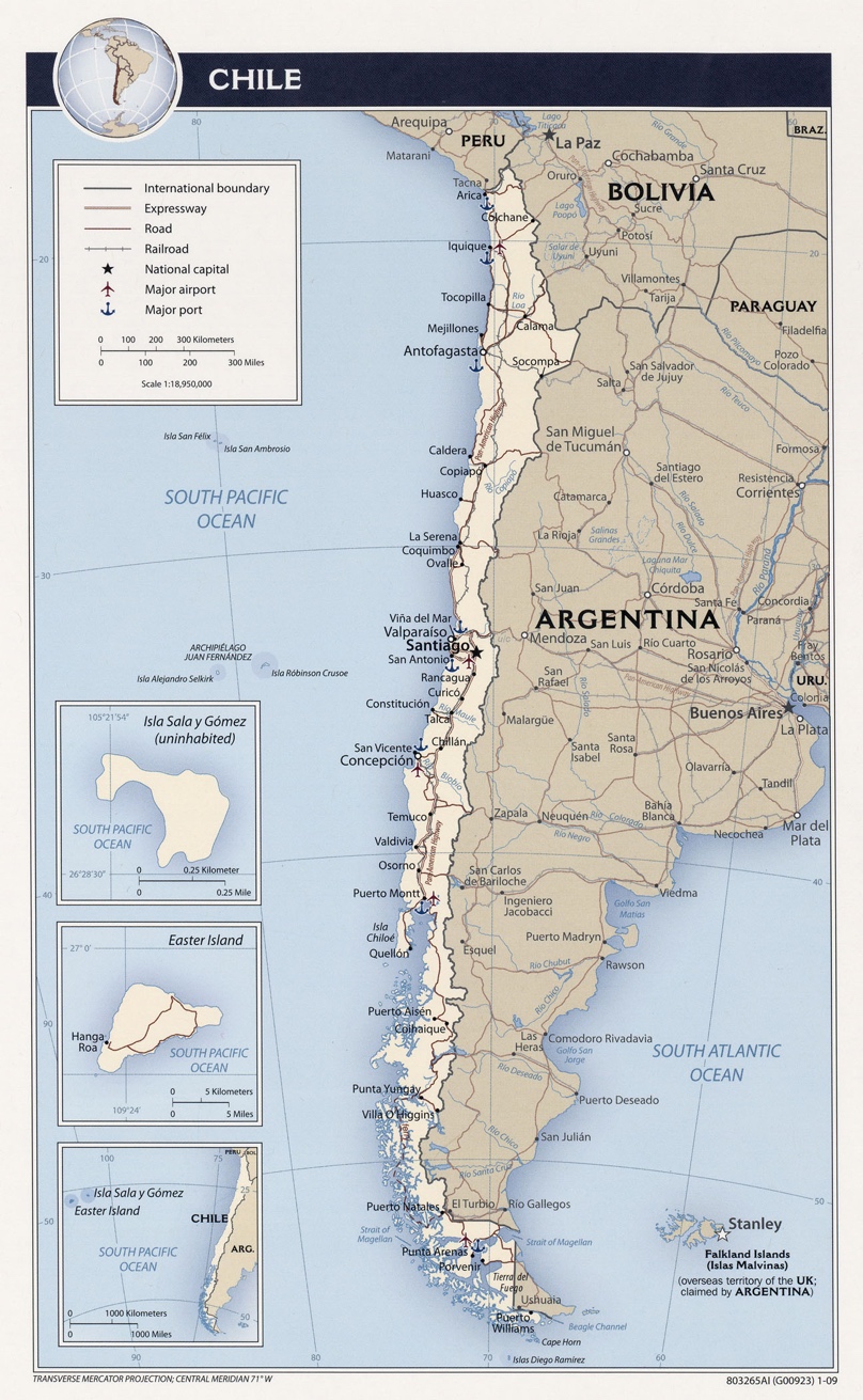
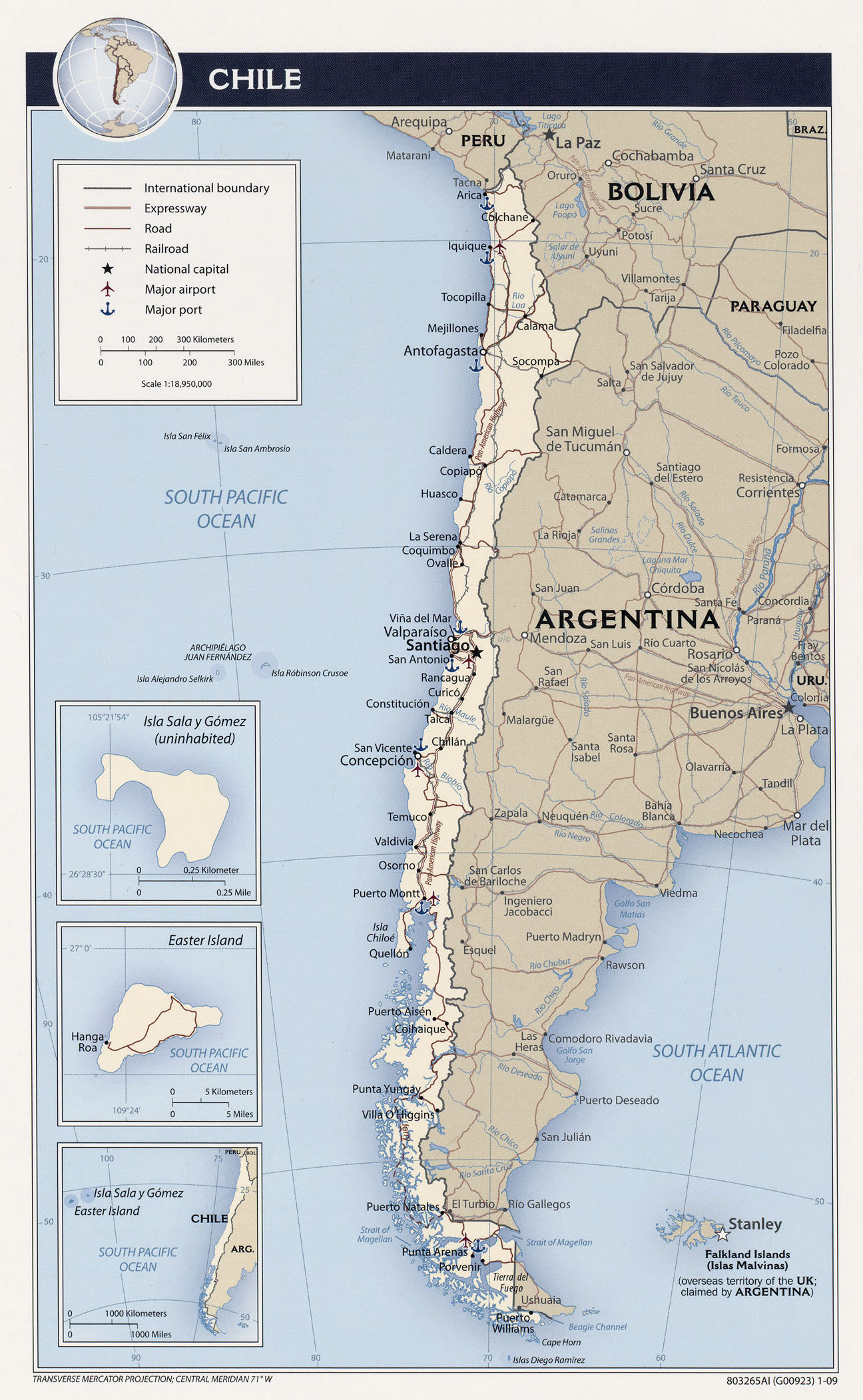
This
map displays the main highways and railways throughout Chile.
Chile
Roads
5 City Maps
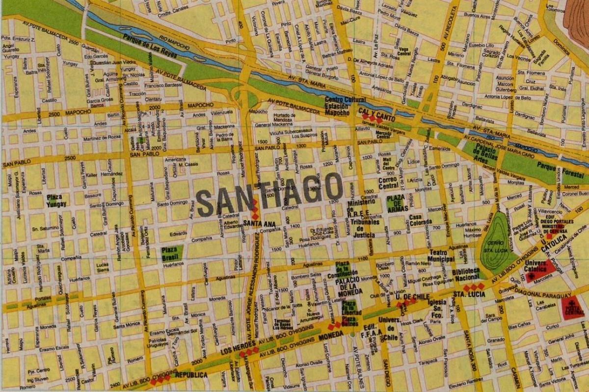
This
map displays the structure of the city of Santiago, Chile.
City of Santiago
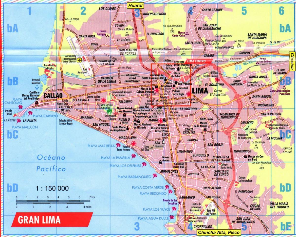
With
this map of Lima, Peru it shows the main destinations of the capital city.
City of Lima
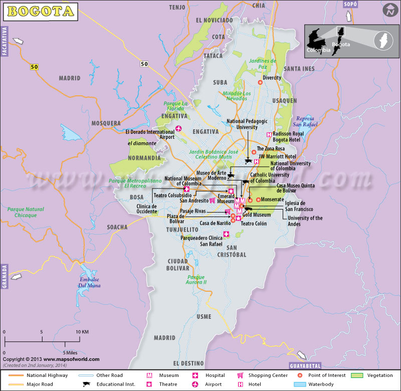
This
map gives an overall good representation of the city of Bogota, Colombia.
City of Bogota
6 Urban
Transportation
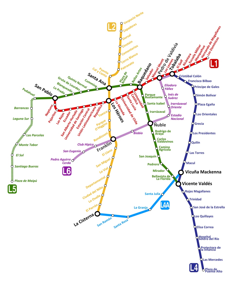
Here we have the map of the subway routes in Santiago,
Chile.
Santiago
Subways
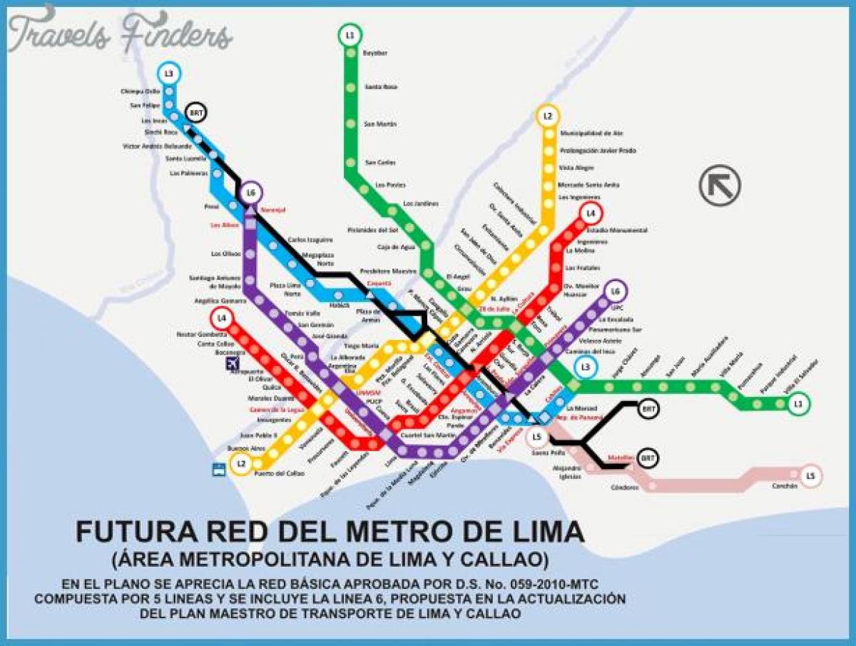
This
map displays main public transportation in Lima, Peru.
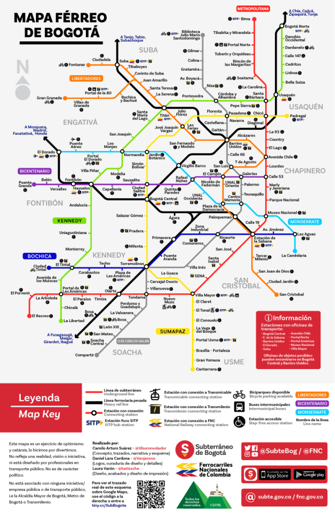
This
map displays all different types of transportation routes throughout the city
of Bogota, Colombia.
Bogota Transportation
7 Tourist Sites
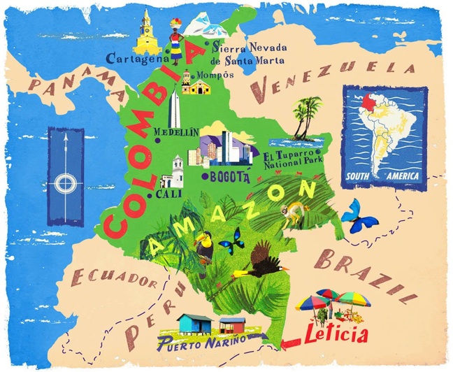
The country
of Colombia has many popular tourist attractions, including some of the ones shown
in this map.
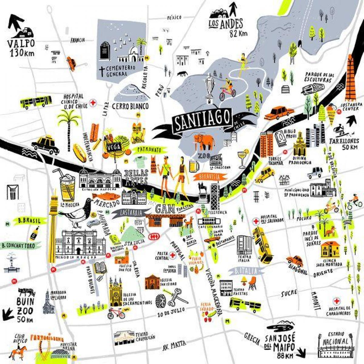
This
map uses illustrations to represent the popular tourist attractions in the capital
city of Santiago, Chile.
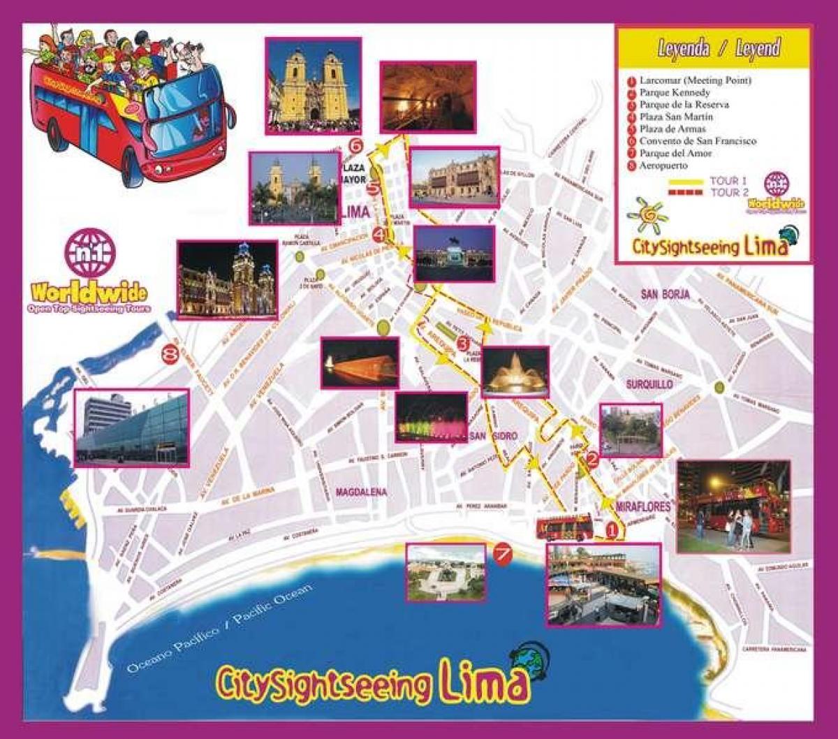
This
map displays the population tourist attractions that you would visit while on a
hop on hop off bus in Lima, Peru.
Submitted
by Hannah Lambert on 3/5/2020.